▲ 437 points
back
69 comments
Hi all! I'm the creator of Stowaway.live and I really appreciate you
posting it here.
All this attention has maxed out my Google 3D Tiles quota, so the ground textures in ride-along mode are being throttled. Everything else works — sky, aircraft and satellite tracking, sound — it's just the terrain that may come in flat or missing. I'm working on a caching layer and a proper fallback rather than just buying my way out of it, and I'd take suggestions if anyone's solved this before.
Thanks for checking it out!
There is good free data available. Consider using EASA Sentinel satellite tiles for the imagery, and JAXA's ALOS Global Digital Surface Model for elevation. And the USGS has higher-resolution lidar elevations in much of the US.
I built a terrain height map completely from free data. https://codetiger.in/earth/
I will look into this, thanks! In the meantime I'm going to implement a fallback to 2D tiles which has much higher quota limits. Try to stop the bleeding first.
It's somewhat old, but NASA has its SRTM height-map dataset. I wrote a project for reading this in Python many moons ago, in case it is of help to anyone:
https://github.com/adamcharnock/python-srtm
I originally used it for doing line-of-sight calculations for a wireless ISP I started.
Europe LiDAR data: https://sonny.4lima.de/
This is very neat! Great job :)
I can empathize with your quota....was gifted a FlightWall recently (https://theflightwall.com) and it constantly throws a 'too many flights' indicator given that I live in a major metro with quite a bit of air traffic. I'm sure it was thrilling and terrifying to see your usage spike. Wishing you all the best of luck!
This is really interesting, I'm making something similar as a gift for my wife ( I didn't know this product existed). It's much smaller but shows a map of planes and their live location in the air space near our home.
I have to say though, it's very weird you're hitting API rate limits. airplanes.live is a free no-authentication needed API that lets you poll it 1 time per second, and with each poll it returns flight information for ALL flights in up to (I think) a 250nm radius.
I doubt this commercial product could use that API but my point is that this data isn't that valuable. Additionally for the size of the thing the could just put and adsb receiver in it....
That is one hilariously overpriced product! Display: $15, Controller: $2, API: Free
Before you do that, check whether you'd be violating the ToS by caching tiles. I'm guessing, yes.
Does this also generate atmospheric weather effects based on real-time weather data? Like if it's raining, would you see rain?
Maybe provide an option for the user to bring their own API key for prettier results.
This is very cool, the ambient sounds are a nice touch.
Can you add the ability to search by satellite ID, or add a "Find the ISS" button?
Don't waste too much on it. I fear popularity is brief.
Ah, that's why the ground is just a grey-green surface.
the map displays some random things, sometimes wrong names of location, sometimes river, sometimes battles (??)
I love this: the sound effects oddly are what really make it. It was quite something clicking a flight, turning round to see behind it, and recognising my location.
What surprised me is how satellites far away (in the night zone, it's daylight for hours yet) could still 'see' me, or rather, I could see them not even that close to the horizon. I would love to see how far away one of the objects is when clicking or hovering over it.
Not working for me on firefox on linux.
Console shows
THREE.WebGLRenderer: Context Lost. index-DMul8aia.js:3819:24355 Object { error: undefined } Stowaway failed to start
It also made firefox actually hard crash to desktop!
Thanks for the report, we'll look into it!
another firefox on linux user (cachyos), and it loaded up and worked flawlessly for me. anecdata!
Pretty amazing. One of those great sites that is just "wow, I would never have thought of trying to build that". And I'm glad you did.
This is fun!
Some constructive feedback:
1. Maybe don't have the view limited by the position on the aircraft- autoswitching between sides would be smoother.
2. Maybe just have double-click on an aircraft initiate ride-along. It's a little clunky and took me a minute to figure out how to ride along as-is.
3. Some kind of overhead view so we could more easily pick out a plane we want to view from would be nice. As it is, I ended up firing up https://globe.airplanes.live/ to find the plane I wanted to view from, then tabbed back to your app to paste the flight number in.
4. Add "reticulating splines" during loading as one of the messages (old Maxis SimCity reference just for fun :P )
Personally I prefer aisle seats. I am 6'2" and the slightly curved space on the window isn't as comfortable for me, same with some trains and busses. Yes the aisle has its own negatives but that's the devil I prefer.
The visualization for the aisle seat is much less interesting than for the window seat.
Maybe that's why they built what they built.
Please add a way to put in my exact long+lat location. Currently it is a slider which is not exact and search bar does not show my exact location. I am hoping to see the airplanes out of my window and then see them in this app.
Super cool. I like how you can hop from plane to plane. However, once I hop to a satellite, it seems like I'm stuck there. It'd be nice if there were more options from that point.
This was so much fun, thank you.
Question for you, and I guess also if you know why Airplanes.live doesn't do this - why not show the destination? I get that airplanes.live is primarily tracking and the source system, (ADS-B/MLAT?) won't show the destination airports, but would it be difficult, at least for you, to integrate a destination lookup?
So there are some free sources I found for departure and arrival destinations, but they were wrong more than they were right, so unfortunately the only way to get reliable information is from a paid source. I may offer this at some point as a paid option down the road if popularity continues.
Oh man, it took a while till i saw the button "Ride along"... but now i understand, nice project!
Oops, I flew through a mountain. How did that happen?
https://i.postimg.cc/Mp3sBrtG/stowaway-20260811-175512.png
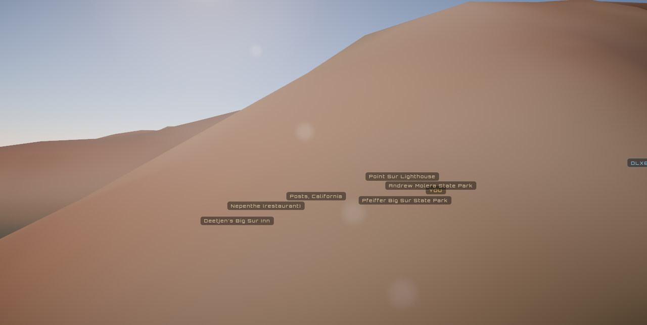
Very interesting! Most likely bad or incorrect altitude or position data from an aircraft transponder.
I love it. I use it to try to trick people into believing it's a live view, and that I work for the government.
This is great. I've been riding along with the air attack plane on the Timber Fire near Big Sur, CA. It would be cool to see the fire perimeter overlay (like in app.watchduty.org).
I wish I could see Google Maps labels like this during a real flight!
Nice work! I got lost in a clouds only view after setting my location but I’m sure I’ll figure it out, the first couple flights were over an unfamiliar area but worked fine.
Truly incredible. How long did it take to build this?
This is great but it would be useful to have some indication of cardinal directions - it is not clear to me which way I am facing.
This is super cool. Made me happy to see what's up in the sky. Bookmarked for when I need a pick-me-up!
Wow, this is really great!
Mind genuinely blown
This is so very cool.
Now could you please sell this to all airlines to replace those terrible, terrible in-flight maps that they show?
Great idea.
Since I'm here, the why:
When I was a kid — back when travelling still felt new and exciting — I would see a plane crossing the early evening sky and try to put myself in it. Not to go anywhere in particular. I just wanted to know what the world looked like from up there, right then, to whoever was sitting by that window.
The feeling was strongest at sunset. I'd be watching a good one from the ground and think about how much better it had to be from up there, above the haze, with the light coming in level. The same sunset from a perspective I couldn't reach.
Travel has lost most of that. Airports, queues, delays: everything wrapped around flying has got steadily worse. But the flying itself hasn't changed. An hour into a clear evening flight, forehead against the glass, looking down at a world you almost never see from that angle, and it is still one of the quietly moving experiences I know.
Stowaway is that part, without the rest of it.
> forehead against the glass, looking down at a world you almost never see from that angle
I'm surprised by how few people seem to do this. I feel like I'm the only adult acting like a child when I do it. Look around and see most everyone else treating it like a night time bus ride through a tunnel.
P.S. Great project name. Stowaway. Perfect.
This is lovely and I feel much the same.
We live pretty close to a flight path and still point at planes as they go past and wonder where they might be going on holiday.
Sadly no longer live close enough that I can see my house when approaching the local airport. That was always cool.
I'm in Central Spain at 5:30am... I was pleasantly surprised to hear crickets. If not for the for the sound of fan and aircon - that is what I would be able to hear coming from my window.
I checked from Brighton, UK, and there is perhaps the same crickets (and birdsong for this time).
I found it quite compelling.
Be cool if you scaled the volume to latitude and chirp-rate to temperature (https://en.wikipedia.org/wiki/Dolbear%27s_law)